Đêm nhạc 'Việt Nam kiên cường' kêu gọi ủng hộ người dân vùng lũ
Đài Truyền hình Kỹ thuật số VTC tổ chức chương trình nghệ thuật “Việt Nam kiên cường” để gây quỹ ủng hộ đồng bào vượt qua bão lũ.
Đài Truyền hình Kỹ thuật số VTC tổ chức chương trình nghệ thuật “Việt Nam kiên cường” để gây quỹ ủng hộ đồng bào vượt qua bão lũ.
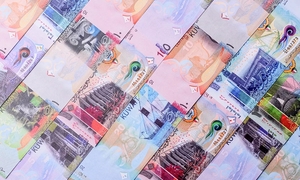
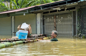
Tính đến17h ngày 14/9, đã có 276 người chết và 76 người mất tích do bão số 3, lũ cuốn, sạt lở đất, sập cầu tại 18 tỉnh, thành phố.
Tính đến 17h ngày 14/9, các tổ chức, cá nhân đã chuyển về tài khoản của Ban Vận động cứu trợ Trung ương là 1.001 tỷ đồng.
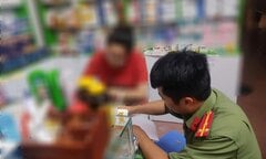
Thủ tướng Phạm Minh Chính chỉ đạo xử lý nghiêm các hành vi vi phạm, kiên quyết không để xảy ra tình trạng găm hàng, tăng giá bất hợp lý, đặc biệt là thuốc chữa bệnh.
Tính đến sáng 14/9, có 345 người chết, mất tích; 1.908 người bị thương do bão, mưa lũ do hoàn lưu bão gây ra ở khu vực Bắc Bộ.
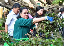
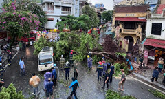
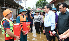
Từ sáng sớm 14/9, Bí thư Hà Nội Bùi Thị Minh Hoài cùng người dân dọn dẹp cây đổ, vệ sinh môi trường sau bão Yagi.
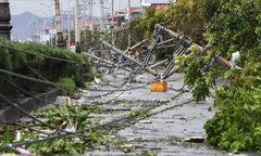
Bão Yagi (bão số 3) đã gây mất liên lạc tại 15 tỉnh, thành phố, với 6.285 trạm thu phát sóng di động bị ảnh hưởng do mất điện, có nhà mạng bị mất trên 50% mạng lưới.
Ủy ban Trung ương MTTQ Việt Nam đăng tải danh sách sao kê số tiền ủng hộ đồng bào thiệt hại do bão số 3 qua tài khoản ở Ngân hàng Vietinbank, từ ngày 10 - 12/9.
Theo số liệu từ Ban Vận động Cứu trợ Trung ương, đến 17h ngày 13/9, các tổ chức, cá nhân đã chuyển về tài khoản của Ban Vận động cứu trợ Trung ương là 775,5 tỷ đồng.
36 tài khoản Facebook, 56 tài khoản Tiktok đã phát tán tin giả trong đợt mưa lũ vừa qua.
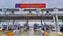
Cục Đường bộ Việt Nam đề nghị nhà đầu tư, doanh nghiệp BOT xem xét, chỉ đạo các trạm thu phí miễn phí dịch vụ sử dụng đường bộ cho xe chở hàng cứu trợ bão lũ.
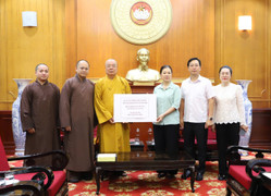
Gần 2.000 cán bộ, nhân viên, người lao động của Tổng cục Hải quan quyên góp số tiền 859,02 triệu đồng ủng hộ đồng bào bị thiệt hại do bão số 3.

Các đơn vị nghiệp vụ Công an TP Hải Phòng vừa triệu tập, xử lý những người đăng tin sai sự thật về vỡ đê ở Hải Phòng, gây hoang mang dư luận trong bão số 3.

Theo luật sư, việc sửa bill chuyển tiền từ thiện đăng lên mạng xã hội gây ảnh hưởng đến hoạt động thống kê, gây dư luận xấu có thể bị phạt đến 7 năm tù.

Nhà sản xuất thông báo hoãn phát sóng tập 11 "Anh trai vượt ngàn chông gai" và sẽ lựa chọn thời gian phù hợp.
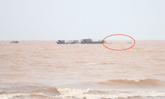
Chính quyền địa phương đang thông báo tìm chủ sở hữu 12 chiếc lồng bè nuôi cá của nước ngoài bị trôi dạt vào các bãi biển ở TP Móng Cái (Quảng Ninh) sau bão số 3.

Ủy ban Trung ương Mặt trận Tổ quốc Việt Nam đăng tải 12.028 trang sao kê tiền ủng hộ đồng bào bị ảnh hưởng bởi bão số 3, với tổng số tiền 527,8 tỷ đồng.
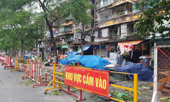
Chủ tịch UBND TP Hải Phòng chỉ đạo ngừng sử dụng 41 chung cư cũ nguy hiểm cấp độ D (hơn 2.600 hộ) bị ảnh hưởng nghiêm trọng bởi cơn bão số 3.
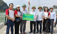
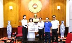
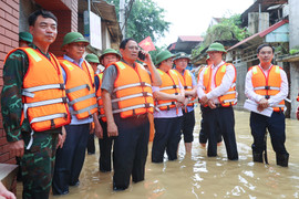
Chủ tịch Hội Nông dân Việt Nam thăm hỏi, trao quà cho hội viên, nông dân có hoàn cảnh khó khăn bị ảnh hưởng, thiệt hại nặng sau bão số 3 tại tỉnh Quảng Ninh.
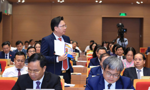
Theo Chủ tịch Quốc hội, chính quyền của Thái Nguyên cần tổ chức ứng trực 24/24 giờ, nắm bắt tình hình để có biện pháp ứng phó bão lũ kịp thời, không chủ quan, lơ là.

Sau khi khắc phục hậu quả của bão Yagi và mưa lũ, nhiều trường đại học thông báo cho sinh viên đi học trở lại.

Ông Lương Quốc Đoàn - Chủ tịch Ban Chấp hành Trung ương Hội Nông dân Việt Nam trao quà cho các hội viên, nông dân bị thiệt hại nặng sau bão Yagi tại TP Hải Phòng.
Chủ tịch Hà Nội yêu cầu lưu ý đảm bảo an toàn tuyệt đối cho lực lượng tìm kiếm cứu nạn, cứu chữa miễn phí cho người bị thương do bão số 3 và mưa lũ.
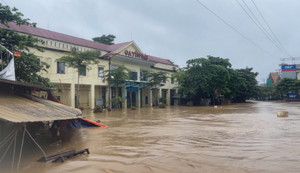
Dù nước lũ tại thành phố Yên Bái đang có dấu hiệu rút nhưng trời vẫn tiếp tục mưa to, đất đá "no nước" nên thường trực nguy cơ sạt lở.

Dãy nhà trên phố Tùng Tung, TP Lào Cai xuất hiện các vết nứt lớn, nền nhà sụt lún, nguy cơ đổ sập bất cứ lúc nào nên người dân phải di dời khẩn cấp.
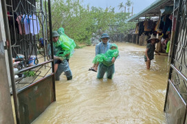
Thủ tướng yêu cầu triển khai lực lượng, phương tiện (kể cả máy bay trực thăng) tiếp cận bằng được để hỗ trợ vận chuyển lương thực, thực phẩm cho người dân.

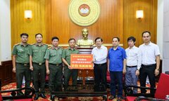
Liên đoàn Bóng đá Việt Nam và đội tuyển Việt Nam phối hợp quyên góp 400 triệu đồng, nhằm khắc phục hậu quả của bão số 3 (bão Yagi).
Ông Nguyễn Đại Cương bị tạm đình chỉ chức vụ Giám đốc Điện lực TP Hạ Long từ 18h ngày 9/9 cho đến khi có quyết định thay thế.
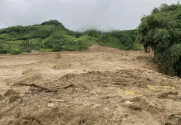
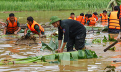
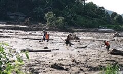
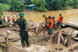
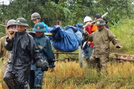
Lũ quét vùi lấp toàn bộ thôn Làng Nủ nơi có 35 hộ dân, 128 khẩu cư trú, hiện xác định trên 30 người bị thương và sống sót, rất nhiều người đang mất tích.
Bão và hoàn lưu bão số 3 gây thiệt hại nặng nề tại các tỉnh, thành phố miền Bắc, đến nay ít nhất 127 người chết, 54 người mất tích, 764 người bị thương.